Visualisation of Development Proposals
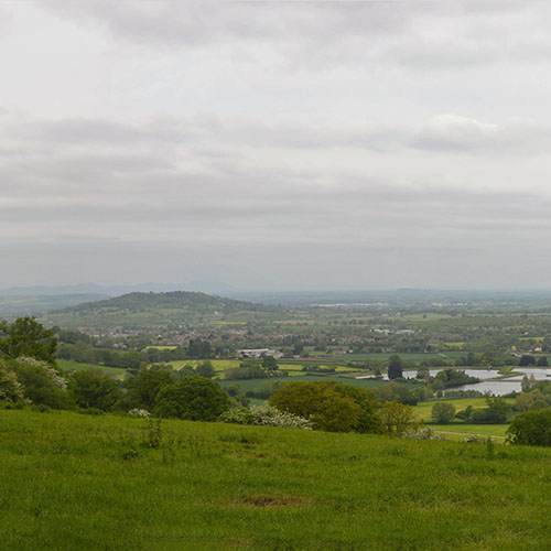
Visualisations are a key part of Landscape and Visual Impact Assessment (LVIA) and Townscape and Visual Impact Assessment (TVIA). They illustrate the likely landscape and visual effects of a proposal and help competent authorities to understand the likely effects.
Last September the Landscape Institute published a new Technical Guidance Note on the Visual Representation of Development Proposals in support of the Guidelines for Landscape and Visual Impact Assessment (GLVIA). This supersedes the previous Photography and Photomontage and Visual Representation Guidance, but a reasonable grace period will still apply.
With more and more Local Planning Authorities referring to the new Technical Guidance Note in pre-application advice and consultee responses it suggests that the reasonable grace period is coming to an end.
The Technical Guidance Note is aimed at helping landscape professionals, planning officers and other stakeholders in the selection, production and presentation of types of visualisation appropriate to the circumstances in which they will be used. In particular, the new guidance outlines appropriate techniques to capture site photography and produce visualisations of varying complexity.
Visualisation Types
The new guidance sets out four types of visualisation which will be typically used within the Landscape and Visual Impact Assessment (LVIA), Townscape and Visual Impact Assessment (TVIA) or Landscape and Visual Appraisal (LVA) that accompanies a planning applications.
- Type 1: Annotated viewpoint photograph. The aim of these visualisations is to represent context and outline or extent of development and of key features.
- Type 2: 3D Wireline/Model. The aim of these visualisations is to represent the 3D form of development, as a stand-alone model without photographic context.
- Type 3: Photomontage / Photowire. These visualisations typically represent the appearance, context, form and extent of development overlaid onto a photograph. These visualisations are prepared to an agreed AVR level (see below).
- Type 4: Photomontage / Photowire Survey / Scale Verifiable. This type of visualisation represents the scale, appearance, context, form, and extent of development overlaid onto a photograph and is the most technical of the four types. Type 4 visualisation is typically used in evidence submitted to Public Inquiry and within LVIA when development is contrary to policy or is likely to be contentious. These visualisations are prepared to an agreed AVR level (see below).
AVR
The London View Management Framework (2012) proposes four levels of ‘Accurate Visual Representation’ (AVR), based on the degree of sophistication of the imagery representing the proposed development.
- AVR Level 0: Location and size of proposal. This equates to a photowire and provides an outline of the proposal overlaid onto the photograph base.
- AVR Level 1: Location, size and degree of visibility of proposal. This shows the massing of the proposal within a 3D context represented by the photograph – that is, what can and cannot be seen.
- AVR Level 2: As level 1 + description of architectural form. This illustrates architectural form such as doors, windows and floors, and gives a sense of the form and shading of the development within its context.
- AVR Level 3: As level 2 + use of materials. This is a fully rendered photomontage, usually photo-realistic with texture, shading and reflections as appropriate.
Technical Methodology
The new guidance is explicit in terms of what technical information should be included within the LVIA/TVIA/LVA methodology and provided alongside each viewpoint photograph. The level of information required depends of the selected visualisation type but at a minimum should include:
- Limitations to the overall methodology e.g. summer/winter views and the impact that this has on the extent of visibility likely to be experienced
- Visualisation Type e.g. Type 1, Type 2, Type 3 or Type 4,
- Projection e.g. Planar or Cylindrical
- Enlargement factor for intended sheet size e.g. 100% @ A3 or 150% @ A1
- Date and Time of captured photography e.g. 29th May 2020, 13:05
- Make and model of camera, and its sensor format e.g. Nikon D3200, CFS
- Make, focal length of the camera lens(es) used e.g. Nikon 35mm
- Horizontal Field of View (HFoV) of photograph / visual e.g. 40°
- Direction of View e.g. looking north-east
Clients should ensure that their consultants are adhering to the latest guidance. Our Landscape Architects can advise on which types of visualisations might be appropriate for your proposed development and the processes involved.